Solution for storing and making available all types of geographical information
About the product
GeoMaps is a Spatial Data Infrastructure, a product developed by Geodouro to support public and private entities in the efficient management of geographic information. The platform was designed to centralise, organise and make spatial data available in a structured, secure and interoperable manner, allowing different departments and systems to access the same information consistently.
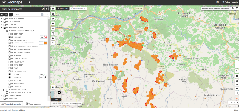
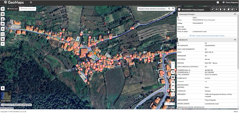
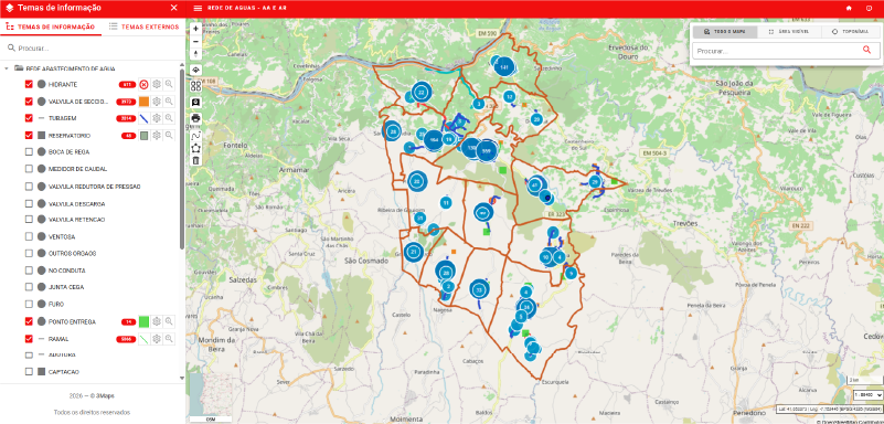
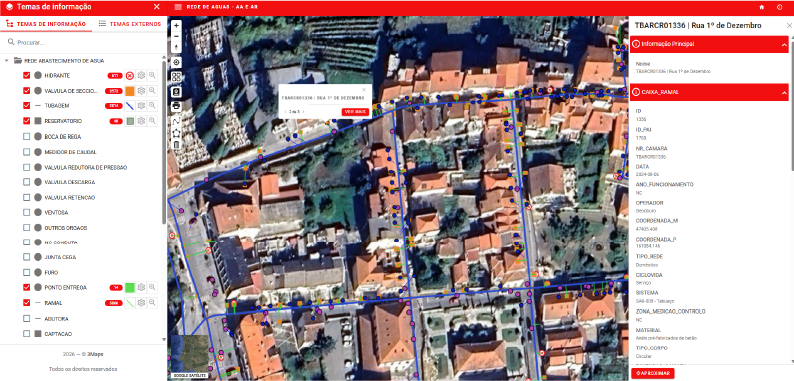
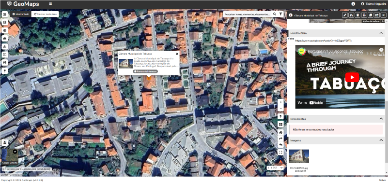
The platform functions as a true Spatial Data Infrastructure (SDI), integrating tools for managing, visualising and sharing geographic data in a single environment. The solution allows data from different sources, such as cartography, cadastre, infrastructure networks, land use planning or field surveys, to be aggregated, ensuring its standardisation, updating and easy access.
Given its high configurability on an entity-by-entity basis, it can be used to manage the following processes:
- Registration and Planning;
- Integrated network management (water, sanitation, gas, etc.);
- Prevention and enforcement;
- Integration with Document and Urban Management processes;
- Integration with One-Stop Shop processes;
- Territorial management instruments – POOC’c, PDM’s, PP’s, PU’s.
The platform supports open and interoperable standards, facilitating integration with other information systems, GIS applications, and web services. This enables organisations to share geographic data between teams, institutional partners, and external systems, promoting more efficient management of territory and assets.
With an intuitive interface and advanced query and analysis tools, GeoMaps allows you to transform geographic data into useful information for decision-making. From municipal management and territorial planning to infrastructure, environment, or energy management, the solution adapts to the needs of each organisation.
By implementing GeoMaps, entities now have a centralised platform that promotes spatial data management, collaboration between teams, and the enhancement of geographic information as a strategic asset.